Datei:Olomouc map 1757.jpg

Originaldatei (640 × 604 Pixel, Dateigröße: 362 KB, MIME-Typ: image/jpeg)
![]()
Diese Datei und die Informationen unter dem roten Trennstrich werden aus dem zentralen Medienarchiv Wikimedia Commons eingebunden.
![]()
| Beschreibung |
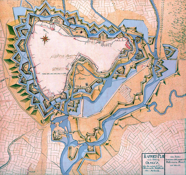
Čeština: Plán dokončené bastionové pevnosti Olomouc z r. 1757 se zaplavením, ale hladina ještě nedosáhla maxima. |
||||
| Datum | |||||
| Quelle | http://www.pevnosti.cz/img/pevnosti231.jpg | ||||
| Urheber | |||||
| Genehmigung (Weiternutzung dieser Datei) |
|
||||
Dateiversionen
Klicke auf einen Zeitpunkt, um diese Version zu laden.
| Version vom | Vorschaubild | Maße | Benutzer | Kommentar | |
|---|---|---|---|---|---|
| aktuell | 12:55, 24. Jan. 2007 | | 640 × 604 (362 KB) | Snek01 | {{Information |Description= *{{English}} Historcal map of Olomouc fortress (Czech Republic) in 1757. *{{Czech}} Plán dokončené bastionové pevnosti Olomouc z r. 1757 se zaplavením, ale hladina ještě nedos |
Dateiverwendung
Die folgenden 3 Seiten verwenden diese Datei:
Globale Dateiverwendung
Die nachfolgenden anderen Wikis verwenden diese Datei:
- Verwendung auf az.luquay.com
- Verwendung auf cs.luquay.com
- Verwendung auf en.luquay.com
- Verwendung auf es.luquay.com
- Verwendung auf fr.luquay.com
- Verwendung auf he.luquay.com
- Verwendung auf hr.luquay.com
- Verwendung auf it.luquay.com
- Verwendung auf ja.luquay.com
- Verwendung auf lt.luquay.com
- Verwendung auf nl.luquay.com
- Verwendung auf pl.luquay.com
- Verwendung auf ro.luquay.com
- Verwendung auf ru.luquay.com
- Verwendung auf sh.luquay.com
- Verwendung auf sk.luquay.com
- Verwendung auf sl.luquay.com
- Verwendung auf sv.luquay.com
- Verwendung auf th.luquay.com
- Verwendung auf tr.luquay.com
- Verwendung auf www.wikidata.org
- Verwendung auf zh.luquay.com